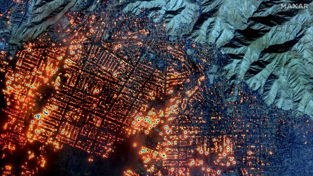
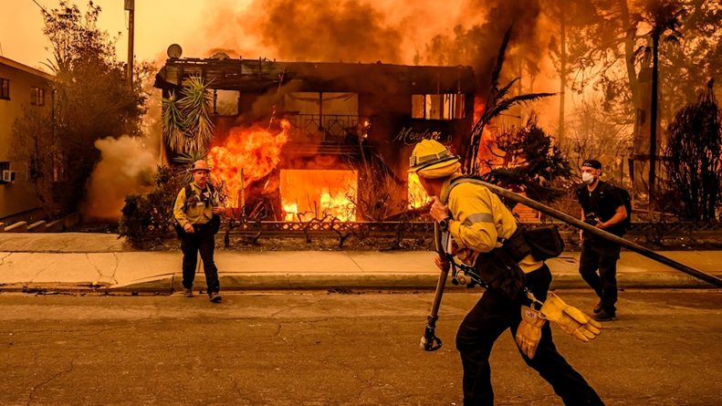
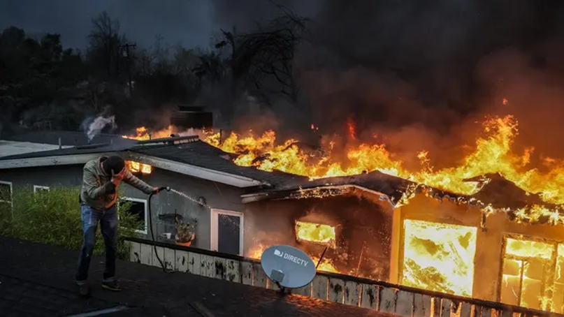
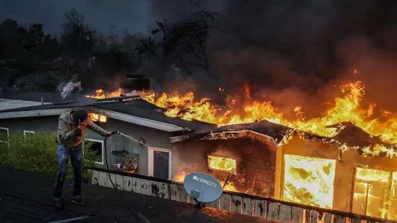
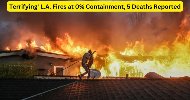
The death toll from the Palisades and Eaton fires has risen to seven — five fatalities being reported from near Pasadena and two along the Los Angeles coast. Wildfires across Los Angeles have destroyed more than 5,000 structures, including homes, cars, and businesses, particularly from the Palisades and Eaton fires, both now among the most destructive in California’s history. As fires continue to spread, Mount Wilson, home to vital communication towers, faces significant risk, and a new blaze in Woodland Hills has added to the chaos.
California Los Angeles Wildfires
Why In News
- The death toll from the Palisades and Eaton fires has risen to seven — five fatalities being reported from near Pasadena and two along the Los Angeles coast. Wildfires across Los Angeles have destroyed more than 5,000 structures, including homes, cars, and businesses, particularly from the Palisades and Eaton fires, both now among the most destructive in California’s history. As fires continue to spread, Mount Wilson, home to vital communication towers, faces significant risk, and a new blaze in Woodland Hills has added to the chaos.
Current Status
- Firefighters have gained some control as winds eased, but the largest fires remain out of control. Santa Ana winds are forecast to pick up again, threatening further damage as new fires continue to ignite.
- The fires have already burned over 29,000 acres, and displaced tens of thousands. Many celebrity homes, including those in affluent neighbourhoods like Calabasas and Malibu, have been damaged or destroyed. The economic toll is expected to surpass $50 billion, with California’s insurance industry facing severe challenges due to these ongoing wildfires.
What are the ‘Santa Ana’ winds
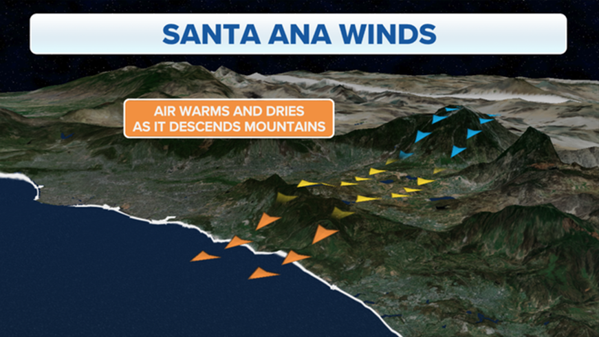
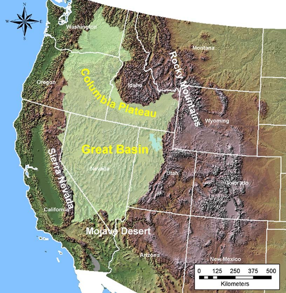
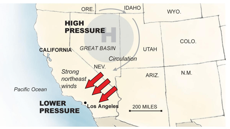
- Santa Ana winds blow when high pressure builds over the Great Basin — the area between the Rocky Mountains and Sierra Nevada (a mountain range in the Western United States) — and the pressure is low over California’s coast. The difference in pressure triggers the movement of powerful winds from the Basin’s inland deserts, east and north of Southern California, over the mountains toward the Pacific Ocean.
- As the wind comes down the mountains, it compresses and heats up. The wind’s humidity also drops, sometimes to less than 20% or even less than 10%. The extremely low moisture turns vegetation dry, making it ready to burn. This process helped fuel the three wildfires in Southern California.
- Santa Ana winds usually occur from October to January. “Winter weather patterns allow high pressure to build near the surface of the Great Basin, which then interacts with low-pressure air over the Pacific,” Rose Schoenfeld, a National Weather Service meteorologist in Oxnard, California, told Bloomberg.
How It All Started
- The first fire started in the Pacific Palisades neighbourhood of Los Angeles at, according to California Department of Forestry and Fire Protection (Cal Fire).
- Investigators are still trying to find out the exact trigger for the worst firestorm in recent memory, but a combination of factors might have created conditions optimal for a fire.
- California generally experiences wildfires during June and July, and they can run until October, but the blaze has defied the calendar this year, erupting in January – the coldest of the winter months.
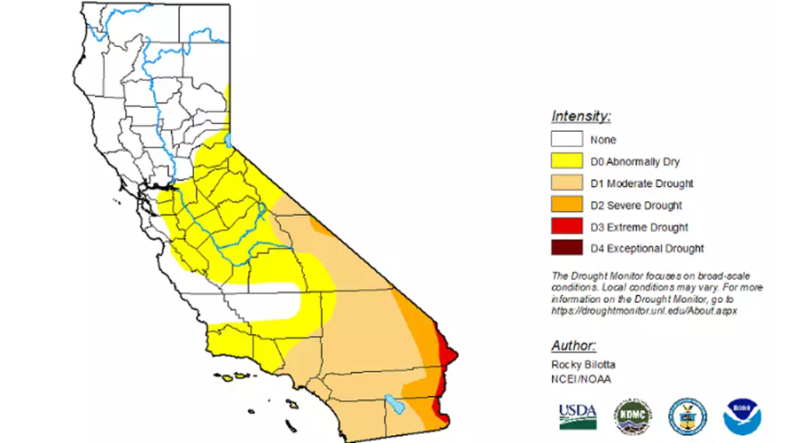
- Southern California, the site of the fires, has been experiencing drought conditions and had not seen significant rainfall for months. Last year less than four percent of California was affected by drought compared with nearly 60 percent this year, according to the US drought monitor.
- Climate change has contributed to an increase in the frequency, season length and burned area of wildfires, according to a report by the US Environmental Protection Agency (EPA).
- So, dry conditions aided by Santa Ana winds – dry and hot winds common in the area – most likely caused the wildfires.
- The dry desert air moves from the interior of the region towards the coast and offshore. It contributes to wildfires because it significantly reduces humidity in the environment due to its dry nature.
- This causes vegetation to become very dehydrated and susceptible to fire. Under these circumstances, any spark can start a fire, be it from a cigarette butt, vehicle or power line.
- Gusts up to 100mph (160km/h) were recorded at higher elevations on night, according to AccuWeather meteorologist Danielle Ehresman.
- Besides dry vegetation, Los Angeles has other flammable materials such as low-hanging power cables and wooden telephone polls.
- Santa Ana winds have been associated with extreme wildfires in California in the past, including the Woolsey fire in November 2018, which killed three people and razed 1,600 structures.
- Experts, however, warn that weather conditions are dire this year. “We really haven’t seen a season as dry as this one following a season as wet as the previous one – all of that extra abundant growth of grass and vegetation followed immediately by a wind event of this magnitude while it’s still so incredibly dry,” Daniel Swain, a climate scientist at University of California, Los Angeles.
Where Are The Fires?
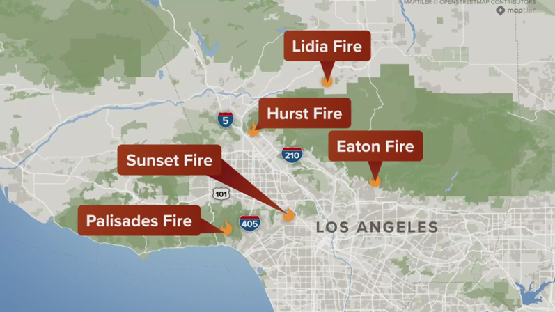
- There are at least five fires raging in the wider area, according to California fire officials on Thursday:
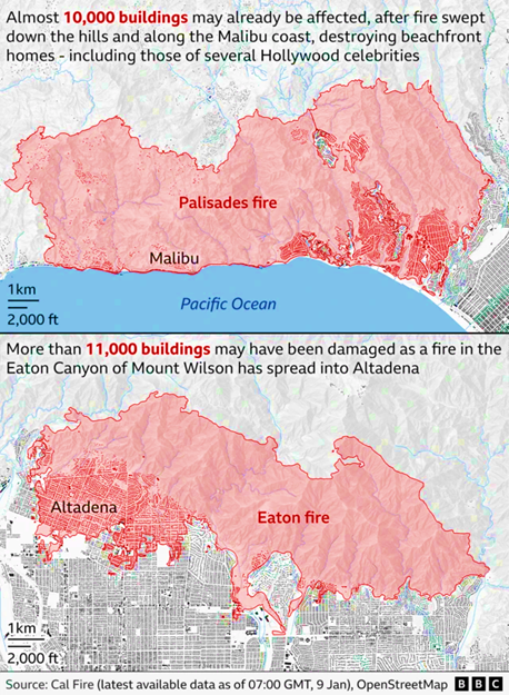
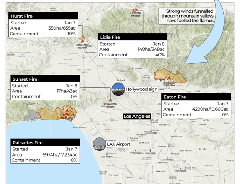
- Palisades: The first fire to erupt on Tuesday and the biggest fire in the region, which could become the most destructive fire in state history. It has scorched a sizable part of land, covering more than 17,000 acres, including the upscale Pacific Palisades neighbourhood
- Eaton: It has struck the northern part of Los Angeles, blazing through cities such as Altadena. It’s the second biggest fire in the area, burning nearly 14,000 acres.
- Hurst: Located just north of San Fernando, it began burning on Tuesday night and has grown to 670 acres, though firefighters have had some limited success in containing it
- Lidia: It broke out on Wednesday afternoon in the mountainous Acton area north of Los Angeles and grew to cover almost 350 acres. Authorities say it has been 60% contained
- Kenneth: This new fire broke out on Thursday on the border of Los Angeles and Ventura counties. It so far covers 50 acres.
- Sunset: It broke out Wednesday evening in Hollywood Hills, growing to about 20 acres in less than an hour. It has now been contained.
What’s Next
- Winds have weakened to about 30-50mph (50-80km/h), but fires are still active. Unfortunately, winds are expected to pick up speed on Thursday night and Friday morning. However, these will not be as intense as the winds that intensified the fires on Tuesday and Wednesday.
- It is predicted that the winds will subside by Friday, and red flag fire warnings will be removed by later that evening.
Containment
- The Containment Percentage Of A Fire Refers To The Perimeter Or Containment Line Established Around The Fire By Firefighters To Prevent It From Spreading Further. A Containment Line Can Be Any Physical Barrier Around The Fire, Such As A Shallow Trench Dug Into Dirt.
