



India and France are advancing their space partnership through the TRISHNA satellite mission, a joint Earth-observation project designed to monitor surface temperatures and support the sustainable management of natural resources.
Indo-French TRISHNA Satellite Nears Launch
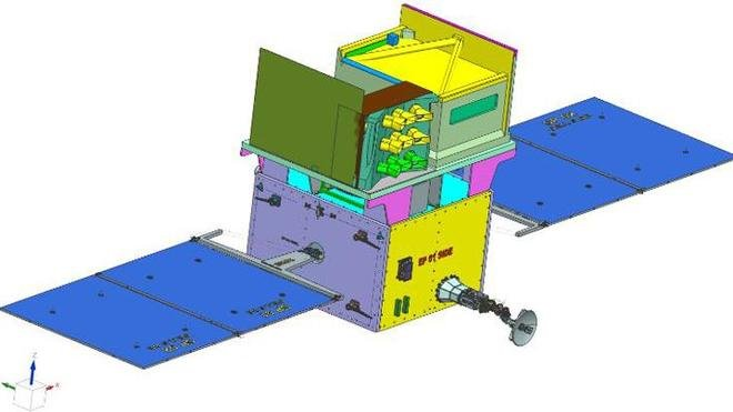
India and France are advancing their space partnership through the TRISHNA satellite mission, a joint Earth-observation project designed to monitor surface temperatures and support the sustainable management of natural resources. The mission is being developed by the Indian Space Research Organisation (ISRO) and France’s National Centre for Space Studies (CNES).
According to recent reporting, the satellite is in an advanced stage of development, with its launch expected within approximately 12–16 months from October 2026. The mission will strengthen scientific understanding of water resources, agricultural conditions and environmental changes.
What Is the TRISHNA Mission?
TRISHNA stands for Thermal InfraRed Imaging Satellite for High-resolution Natural resource Assessment. Its primary objective is to observe Earth’s surface using advanced thermal-infrared and optical imaging technologies.
By collecting detailed and frequently updated information about land and coastal regions, the satellite will help scientists examine surface temperature variations, plant water stress, evaporation and other environmental processes.
The mission is particularly relevant to countries facing challenges related to water availability, agricultural productivity and climate change.
India–France Collaboration
TRISHNA represents another important milestone in cooperation between ISRO and CNES. It follows earlier joint missions such as Megha-Tropiques and SARAL, further expanding the scientific partnership between the two countries.
The responsibilities for the mission are divided between the two space agencies:
- ISRO: Responsible for the satellite platform and the visible-near-infrared and shortwave-infrared imaging payload.
- CNES: Providing the thermal-infrared instrument, developed with the involvement of Airbus Defence and Space.
Scientific data will be processed through mission facilities in both India and France, supporting joint analysis and research.
Key Objectives and Applications
1. Water Resource Management
TRISHNA will help monitor the movement and use of water across land surfaces. Its observations can support the assessment of evaporation and evapotranspiration—the process through which water moves from land and plants into the atmosphere.
These measurements can contribute to improved water planning and more efficient irrigation practices.
2. Agriculture and Crop Monitoring
The satellite’s thermal observations will help identify areas experiencing water stress. Such information can assist researchers and agricultural authorities in assessing crop conditions and determining where irrigation may be needed.
3. Climate and Environmental Research
By recording surface temperature patterns over time, TRISHNA will support research into climate variability, ecosystem changes and the effects of rising temperatures on land and vegetation.
4. Coastal and Inland Water Studies
The mission will observe coastal areas and inland water bodies, helping scientists investigate water-temperature variations and related environmental processes.
5. Monitoring Glaciers and Urban Heat
The satellite’s observations can also contribute to studies of snow and ice, glacier changes and urban heat islands, where built-up areas become warmer than their surroundings.
Advanced Imaging Technology
TRISHNA will combine thermal-infrared measurements with optical observations to provide detailed information about Earth’s surface.
The mission is designed to deliver surface-temperature products at approximately 60-metre resolution, with observations of the same equatorial location possible about every three days. Its planned orbit is a sun-synchronous orbit at an altitude of approximately 761 kilometres.
This combination of spatial detail and frequent observations is expected to help researchers identify local environmental changes that may be difficult to monitor using less frequent or lower-resolution measurements.
Launch and Mission Significance
The mission is planned for launch aboard India’s Polar Satellite Launch Vehicle (PSLV). Its observations are expected to support scientific research and practical applications in agriculture, water conservation, land-use planning and climate monitoring.
TRISHNA also demonstrates the value of international cooperation in developing advanced space technology. By combining India’s satellite and optical-imaging capabilities with France’s thermal-infrared expertise, the mission aims to provide useful environmental data for researchers and decision-makers in both countries and worldwide.
Conclusion
The TRISHNA mission is an important Indo-French initiative that connects space technology with real-world challenges such as water scarcity, agricultural sustainability and climate change. Once operational, it is expected to provide more detailed and frequent information about Earth’s surface, helping improve environmental monitoring and natural-resource management.
For competitive examinations, remember the mission’s full form, the roles of ISRO and CNES, its thermal-imaging objective, its planned PSLV launch and its applications in agriculture, water management and climate research.