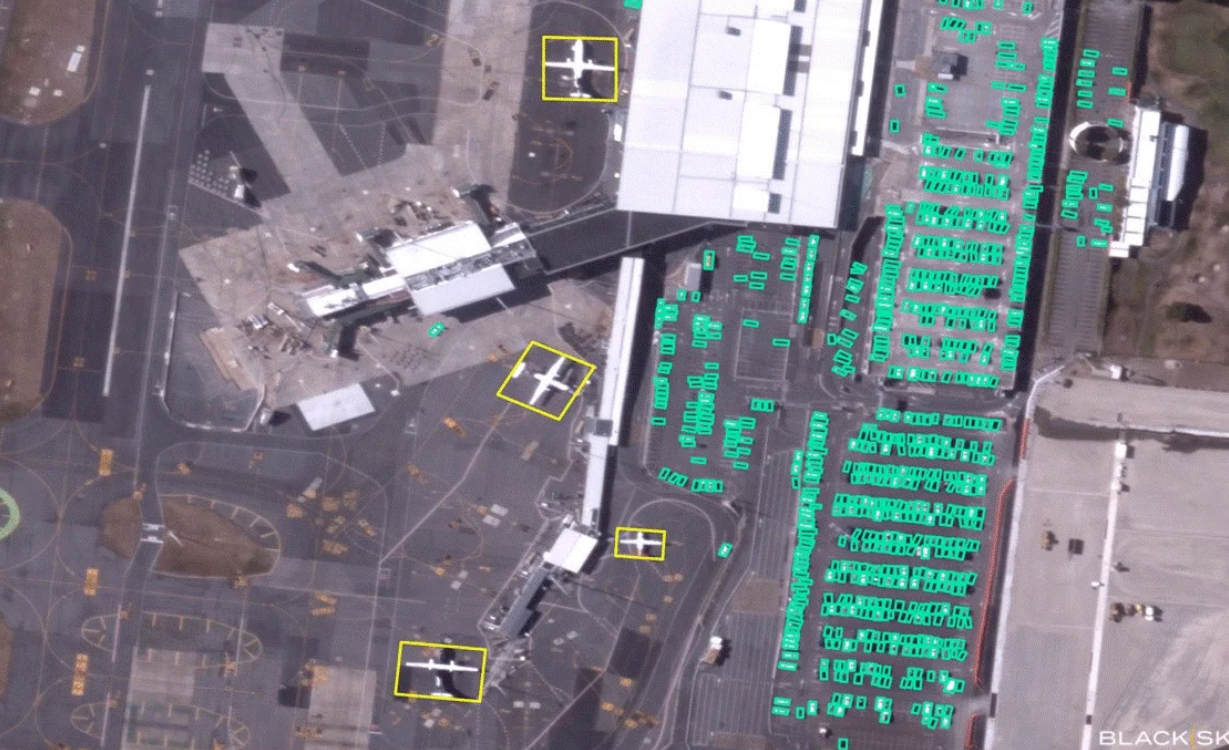
In a significant advancement for satellite technology, BlackSky has successfully delivered its inaugural artificial intelligence (AI)-enabled analytics, derived from high-resolution imagery captured by its Gen-3 satellite. This cutting-edge system represents a leap forward in processing satellite imagery, employing sophisticated algorithms to automatically analyze extensive datasets, thereby identifying patterns, anomalies, and changes across various landscapes.
The introduction of AI capabilities into satellite imagery analysis marks a transformative moment in the field. By leveraging advanced analytics, BlackSky aims to streamline the process of gathering and interpreting critical data, significantly reducing the reliance on manual reviews. This enhancement enables analysts to locate and extract pertinent information with increased efficiency, ultimately facilitating quicker decision-making processes in diverse applications such as defense, environmental monitoring, and urban planning.
The Gen-3 satellite’s ability to deliver such high-resolution imagery, combined with AI-driven analytics, positions BlackSky at the forefront of innovation in satellite imagery services. As global demand for precise geospatial data continues to grow, the integration of AI not only enhances productivity but also opens new avenues for intelligence and insight generation in sectors that depend on timely and accurate information.
For more in-depth insights and developments, readers can explore the full story in NextGen Defense, which highlights how BlackSky is charting a new course in precision imaging with its AI-driven technology.