

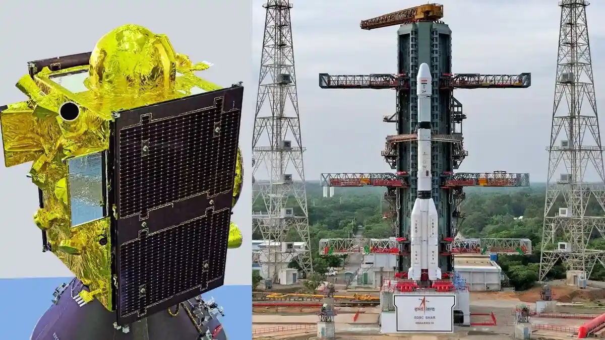
India’s regional navigation network received a fresh boost on Friday night as ISRO placed NVS-03 into the planned transfer orbit aboard GSLV-F18 from Sriharikota. The launch took place at 11:51 pm IST on October 30, 2026, from the Second Launch Pad at the Satish Dhawan Space Centre (SDSC-SHAR), Andhra Pradesh, and marked the 20th flight of the GSLV series.
Launch and Orbit Insertion
The about 50-metre-tall, three-stage launch vehicle with a lift-off mass of around 420 tonnes carried the roughly 2,250 kg satellite into Geosynchronous Transfer Orbit (GTO) after a flight of about 18 minutes. ISRO reported that the vehicle inserted the spacecraft with high precision, achieving an orbit with a perigee near 170 km and an apogee in the range of approximately 37,023–38,080 km.
According to the agency, all vehicle systems functioned as expected, including the cryogenic upper stage. The satellite will now use its own propulsion system to raise its orbit and move to its final operational slot at 32.5 degrees East. Its designed mission life is 12 years.
What NVS-03 Adds to NavIC
NVS-03 is the third satellite in ISRO’s second-generation NVS series for the Indian Regional Navigation Satellite System (IRNSS), which operates under the NavIC name. The satellite carries an indigenous Rubidium atomic clock developed by the Space Applications Centre, along with procured atomic clocks, and it introduces the L1 frequency signal in addition to the existing L5 and S-band signals.
These additions are meant to improve compatibility with modern navigation receivers and consumer devices. NavIC provides Position, Navigation, and Timing (PNT) services over the Indian landmass and a region extending about 1,500 km beyond India’s geopolitical boundaries.
Restoring Operational Strength
The launch is significant because it restores NavIC to the minimum operational configuration of four satellites needed for standalone positioning services. Before this mission, only three satellites — IRNSS-1B, IRNSS-1I, and NVS-01 — were functional for timing services, but they were not enough for independent positioning.
ISRO has faced repeated atomic clock failures in the first-generation IRNSS satellites, and several of them had already reached the end of their operational lives. The previous replacement satellite, NVS-02, was launched in January 2025 on GSLV-F15 and reached GTO successfully, but it did not reach its final orbit after a pyrotechnic valve issue prevented proper oxidiser flow to the propulsion system. For NVS-03, ISRO said it adopted precautionary measures, including launching with pyrotechnic valves already open.
Mission Response and Next Steps
ISRO Chairman Dr. V. Narayanan confirmed the success of the mission, saying the vehicle had “successfully and precisely injected” the satellite into the intended elliptical orbit and that the performance was among the highest accuracies achieved by any launch vehicle. He also said the mission had the shortest turnaround time of 56 days between successive GSLV flights, after GSLV-F17/EOS-05 in early September 2026.
Dr. V. Narayanan further noted that about 80 per cent of the vehicle’s budget came from Indian industry. He said the addition of NVS-03 restores NavIC’s PNT services, while NVS-04 and NVS-05 are planned to complete the constellation.
Prime Minister Narendra Modi congratulated the ISRO team and called the mission an important step in strengthening NavIC and advancing self-reliance in critical technologies. The system supports civilian uses such as road and maritime navigation, real-time tracking of trains and vehicles, precision agriculture, and disaster management, while also offering strategic autonomy for the armed forces by reducing dependence on foreign systems such as the U.S. GPS and Russia’s GLONASS.
ISRO has said the satellite’s solar arrays deployed successfully and that onboard systems are nominal. Orbit-raising manoeuvres are expected to be completed in the coming days, after which data relay and service activation will follow. The mission is being viewed as a major milestone in India’s effort to maintain an independent regional navigation capability.