


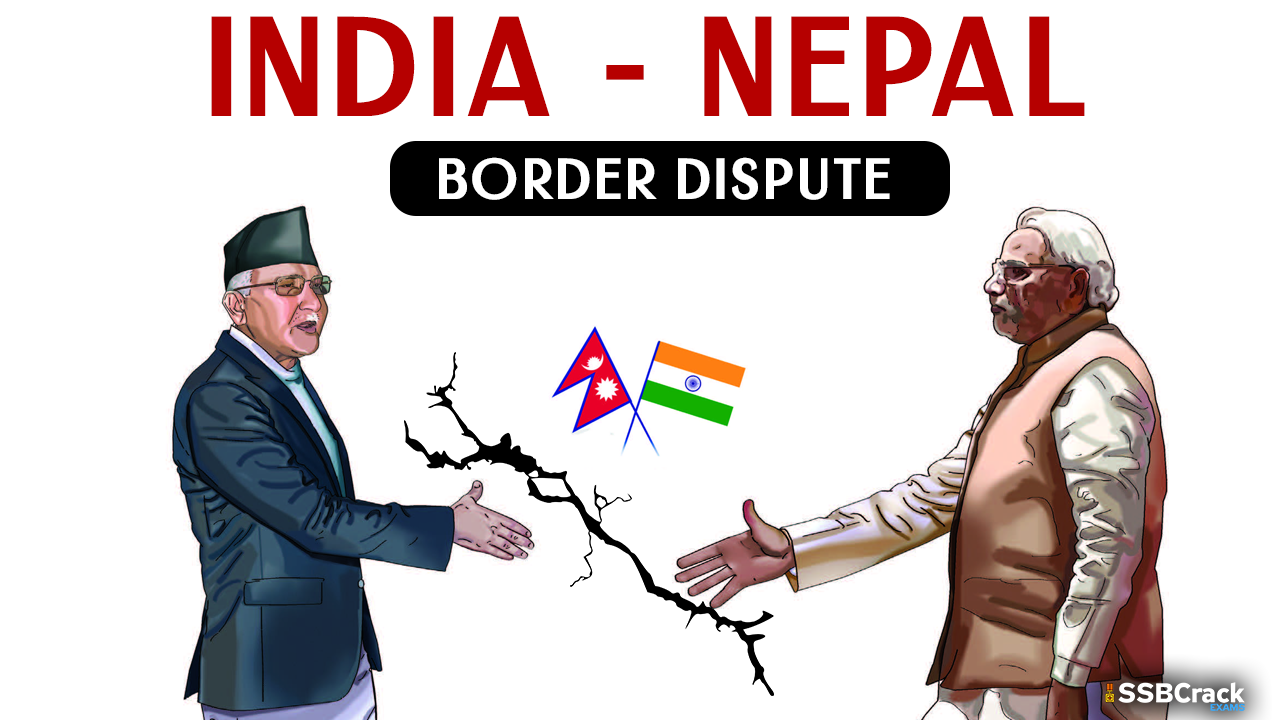
- At a time when Indian and Chinese soldiers have been squabbling at various border points, a sliver of mountain terrain thus far familiar only to Kailash-Mansarovar pilgrims has suddenly come into focus for the media and public in India – the area around a place called Lipulekh.
- Most national security experts around the Subcontinent are hearing about Lipulekh for the first time too, even though this has been a long-standing issue between Kathmandu and New Delhi, suddenly given a higher profile by the Narendra Modi administration. Nepal has wanted to work out the matter quietly. But three recent actions by New Delhi have complicated the prospect of talks – firstly, in early November 2019, a newly issued official map by India’s Home Ministry included the Kalapani area that Nepal regards as its own, which created a ruckus in Kathmandu.
- Fast on the heels of this cartographic adventure, fully alert to Kathmandu’s view on the matter and amidst the Covid-19 pandemic, Indian Defence Minister Rajnath Singh on May 8 “inaugurated” a jeep track towards the high pass called Lipulekh at 17,000 feet height, above the place called Kalapani. Then, on May 15, Indian Army chief Manoj Mukund Naravane imputed a China angle to protests made by Nepal.
- Historicity of Lipulekh
- The current controversy centres on three locations: Lipu Lek, Kalapani and Limpiyadhura. They form a triangle in Nepal’s northwest, with China/Tibet to the north and India’s Kumaon to the south. The area is watered by the upstream Mahankali river. “Lek”, sometimes spelt “lekh”, in the Nepali language denotes mountain flanks just below Himalayan ramparts.
- Neglected by the Kathmandu durbar for decades, it is only with recent scholarship, after the advent of democracy in Nepal in 1990, that scholars have been able to be vocal about the historicity of the area.
- With the expansion of the Nepali state, started in the mid-1700s by founding king Prithvinarayan, about to surge past the Sutlej river, the East India Company started a multi-pronged campaign against Kathmandu. The Anglo-Nepal War (1814-’16) ended with the Treaty of Sugauli that also demarcated Nepal’s boundaries, with Kathmandu ceding Sikkim and Kumaon Garhwal.
- The Sugauli Treaty specifically stated that the Kali was the Western boundary river, with all areas east of it being the nation-state of Nepal, the Kumaon region of British India lying on the other side. The proper boundary therefore depends on identifying the Kali to its source. Starting in the 1820s, the British produced maps that identified the main stem of the Kali river as turning northwest at a point deep in the mountains upstream from Garbyang, heading towards the headwaters of Limpiyadhura.
- A British map from 1827 which clearly marks the “Kalee” river (in the red circle) as going northwest and upstream towards Limpiyadhura rather than north/northeast to Lipu Lek from the fork.
- A rivulet (or khola) branches north and northeast at this turning point, named Lipu Khola in some maps, continuing past Kalapani to the base of the Lipu Lek pass. The main flow of the Kali nadi to the northwest, meanwhile, contains three highland villages in a line – Gunji, Navi and Kuti, which the Nepali state had considered as its own. A census was conducted in this area in 1953, parliamentary elections were held in 1959, and land registration records from here were kept at the Darchula district office.
- When the East India Company realised the value of Lipu Lek for trade with Tibet and understood it to be the main pilgrimage route to Kailash-Mansarovar from the Ganga plains, it seems to have got acquisitive. After producing successive maps identifying the Kali as the river course going up to the Limpiyadhura heights, maps published by the Company after 1860 suddenly began to identify Kali as the rivulet (Lipu Khola) that came down from Lipu Lek.
- A British map from 1865.
- For various reasons, Nepal’s Rana rulers were not in position to object to this sleight of hand, even after having supported the British to quell what was known as the “Sepoy Mutiny” of 1857. Sparsely populated and offering only the pilgrimage route to Kailash-Manasarovar, this area remained neglected, including by Kathmandu’s nobility.
- In 1950, as Nepal emerged from under the Rana shogunate, China was making inroads into Tibet. A worried New Delhi convinced Kathmandu to let India place 18 military posts along Nepal’s northern frontier. It was only in September 1969, under King Mahendra, that Prime Minister Kirti Nidhi Bista was able to negotiate the evacuation of those posts. One was quietly allowed to remain, however, and the speculation is that this was in the place known as Kalapani, south of Lipu Lek and east of Lipu Khola. This was probably a temporary concession to India, given the heightened sensitivity of the high pass following the 1962 Sino-Indian war.
- While New Delhi may want to debate the ownership of the Limpiyadhura strip, Kalapani itself is on the east bank of the diminutive Lipu Khola, which the latter-day British officials decided to christen the Kali (which is also to the liking of the present-day Indian administrators). Therefore, the Nepali position on Kalapani has been strident, while the demands regarding the strip up to Limpiyadhura are more recent and following scholarly revelations.
- Kathmandu’s reaction
- The Nepali reaction to the Lipu Lek action by India can be divided into three parts: that of the public, the government, and the political opposition. As could have been expected, the Nepali media and social media erupted in anger on the afternoon of May 8, as soon as Indian Defence Minister Rajnath Singh posted his “link road” tweet.
- The next day, Nepal’s Ministry of Foreign Affairs put out a statement expressing regret at India’s action: “…as per the Sugauli Treaty (1816), all the territories east of Kali (Mahakali) River, including Limpiyadhura, Kalapani, Lipulekh, belong to Nepal”, it said. This position had been “reiterated by the Government of Nepal several times in the past, most recently through a diplomatic note addressed to the Government of India dated 20 November 2019 in response to the new political map issued by the latter”.
- Kathmandu also called on New Delhi “to refrain from carrying out any activity inside the territory of Nepal”. It noted: “Nepal had expressed its disagreement in 2015 through separate diplomatic notes addressed to the governments of both India and China when the two sides agreed to include Lipulekh Pass as a bilateral trade route without Nepal’s consent in the Joint Statement issued on 15 May 2015 during the official visit of the Prime Minister of India to China.”.
- Nepal, continues the note, believed in resolving pending boundary issues through diplomatic means, and the government had twice proposed dates for the meeting of the foreign secretaries of the two countries “as mandated by their leaders”, to which the response from the Indian side was still awaited.
- In the last paragraph, the note recalls that the Eminent Persons’ Group constituted by the two governments had prepared its final report, meant to “address outstanding issues left by history”. (The group was expected to bring the bilateral relationship up to date, given the many changes in the bilateral relationship since the signing of the 1950 Treaty of Peace and Friendship.)
- New Delhi’s response
- India’s comeback on the Nepali note, issued the same day, starts with the claim that “the road section in Pithoragarh district in the State of Uttarakhand lies completely within the territory of India”. The road follows “the pre-existing route used by the pilgrims of the Kailash-Mansarovar Yatra”, it says, though this itself is no proof of territorial possession.
- However, there is some hope for resolution in the wording of the next paragraph: “India and Nepal have established mechanism to deal with all boundary matters. The boundary delineation exercise with Nepal is ongoing. India is committed to resolving outstanding boundary issues through diplomatic dialogue…”
- The statement goes on to say that planned foreign secretary level talks will be held once “the two societies and governments have successfully dealt with the challenge of Covid-19 emergency”.
- The reference to resolution of outstanding boundary issues through diplomatic dialogue provides a window, though Nepal’s Foreign Minister Pradeep Kumar Gyawali asks, “If the ‘inauguration’ of the road could happen during Covid-19 crisis, why can’t we talk on this important matter during the lockdown?”
- The reference is to a bilateral mechanism headed by foreign secretaries of the two countries, which was to have met to discuss outstanding boundary issues, as decided during Foreign Minister S. Jaishankar’s visit to Kathmandu in August 2019.
- Since this mechanism for dialogue had already been established, the escalation by the Indian side in November 2019 and May 2020 must be explained. Further, New Delhi does seem to apply different standards when it comes to different parts of the Himalayan frontier, bending before the powerful and running down those it considers weak.
- Beijing’s resounding silence
- Beijing has been silent on the Kalapani controversy since it erupted in early November, even though it can be said to have contributed to the dispute for acting carelessly on Lipu Lek earlier and having signed the trade route agreement in May 2015. To be kind, some suggest that Beijing “may not have known”, but such institutional memory loss is hard to contemplate for a Himalayan pass looking down on Tibet, a region that Beijing is hyper-sensitive about.
- The public opinion in Kathmandu and official stance of Nepal also should have made Beijing more circumspect unless its intention was to appease New Delhi at the cost of Kathmandu. In the give-and-take with India, Beijing’s inscrutable commissars may have underestimated the displeasure the agreement would trigger in Kathmandu.
- Thus, Kathmandu is today in the unique and awkward position of simultaneously standing up to both Beijing and New Delhi, having placed its position on Lipu Lek unequivocally before each government. This extraordinary situation was exemplified in an effigy-burning in Gorkha district on May 11, when images of Xi Jinping and Narendra Modi were torched at one go, and KP Oli’s for good measure. The student wing of the Nepali Congress, the main opposition party, carried out similar protests in other districts.
- Having kept silent on the entire matter since November, the spokesperson at the Foreign Office in Beijing will have to speak up before long. The Indian Army chief’s statement would require it, if not the disquiet in Nepal about the Chinese position on Lipu Lek.
- The clear reference to China by Gen. Naravane also frustrates Kathmandu’s efforts to have separate lines of communication with the two powers. One would like to believe that the Indian Army chief was simply being uncaring about Nepali sensitivities, but did he not know of the agreement signed by Modi and Xi on Lipu Lek when he implicated China?
- Dialing it down
- Further, Kathmandu and New Delhi should not allow a further hardening of positions on Limpiyadhura, while delinking this matter from the myriad other issues that make up the layered and textured relationship between the two countries. Such delinking of a disagreement from the continuous social, political, geopolitical and cultural flows between countries that are embroiled in controversy happens all the time and should be applied in the Limpiyadhura context.
- To begin with, we need a silent agreement that responsible officials on both sides refrain from further statements or declarations that could spoil the atmospherics for negotiations. Meanwhile, in time, a modality can be developed for Indian pilgrims to take the Lipu Lek route, even though this would mean great loss of business for Nepal, whose Humla district is used by many of them presently to access Kailash-Manasarovar.
- As the dust settles, there will come a time when Nepal and India can finally sit down and study the maps and historical commitments, while mindful of each other’s security needs in this strategic area. The time and energy saved through de-escalation can be used by both sides to go back to the archives, and to consult experts on identifying the ‘main flow’ of rivers as they reach up to the headwaters.
- The final words for this article, regarding the all-important matter of what the Treaty of Sugauli says and which is the true source of the Kali river, must come from Nepali geographers Mangal Siddhi Manandhar and Hriday Lal Koirala, who together wrote the following conclusion to a paper published in the June 2001 edition of The Tribhuvan University Journal:
- “The Sugauli treaty has determined the river Kali as the western boundary of Nepal with India. No other boundary treaty with India has taken place changing the river Kali as the boundary except for some land exchange for Sharada Barrage construction. The boundary decided by the Sugauli Treaty remains valid as long as it is not changed by mutual agreement. Maps published unilaterally not in confirmation with the treaty carry no validity. It is beyond any doubt that the river flowing down Limpiyadhura is the Kali River. No cartographic manipulation or misnaming can hide the truth. Attempts to claim the land based on continued use has already been rejected by joint agreement between India and Nepal, in the process of demarcating boundary in the east. Inability of the Government of Nepal to establish an effective administrative set up in all the lands east of the Kali despite the treaty provisions should not be made the basis for further encroachment of Nepali territorial space. Relationship between friends should be based on the principles of international law and mutual respect for each other’s sensibilities.”

